George has been sailing dingies since 1973. He built this very seaworthy 19'6" Drescombe Peterboat himself. It carries 175 sq.ft. of sail, weighs 1200 lbs and has a beam of 3'6".
Skipper: George Gutsche

George and I want to tell you about our time with the Arway. We were in
We kept boat shopping for a few more weeks and finally bought a Grand Mariner that same spring and enjoyed her for 7 years. When we decided to sell our boat we noticed the Arway was once again up for sale! This time we made a purchase and the Arway has become George's favorite past time as he keeps her in great shape. We have enjoyed comfortable, economical cruising as she is a tri-cabin trawler
with a sailboat hull.
We have chartered for eight years as far north as the Broughton Archipelago, Desolation Sound, Princess Louisa Inlet, Sechelt Inlet and the whole of the Gulf Islands but in the last 6 years just the two of us love to spend at least two to three months cruising each summer through fall often accompanied by a motley crew of grandchildren, family and friends.
Skipper: George Williamson
First Mate: Jo Williamson


Clean Sweep, French
Black lab

Twenty-one year old Vanessa has sailed her entire life, and Susan and I started sailing together 40 years ago in an 11-foot long
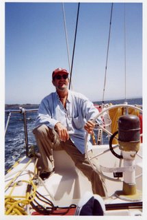
Skipper: Rob Scott
First Mate: Susan Scott
Crew: Vanessa Scott
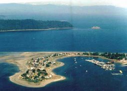
 Sperrin is a 35' C&C Sloop built in 1970. She is reputed to be the first C&C in BC and graced the cover of the February 1970 issue of Pacific Yachting. Her first owner campaigned her very successfully on the West Coast racing circuit under her original name, Tangent II. He sailed her until 1999 when she moved to the second owner on Bowen Island. We purchased the boat in 2003 and have sailed her around the Gulf ever since.
Vessel Preparedness
The Around-Together cruise is a mere 3 months away, so below is a helpful checklist to keep you focused on being prepared for our departure date.
*
* Machinery
* Sails
* Rigging
* Tender
* Electronics – GPS
* Radios: DSC?
* Sounder
* Radar
* Electronic navigation
* Navigation & anchor lights
*
* Anchor & rode
* Killet
* CCGA inspection – April 21st & 22nd
* Charts
* Piloting tools
* Publications (Sailing Directions, PAC Tide 5 & 6, Cruising guides )
* Radar reflector
* Compass
* Fire extinguisher check & recharge if necessary
* Tender & equipment (oars, painter, etc.) (CCGA)
* Life jackets
* Harness & jack lines
* Spare engine parts
* Rigging fittings
* Sails
* Lines
Water Supply # ______ gallons # ______ days
Fuel Supply
Gas: # ______ gallons # ______ days
Diesel: # ______ gallons # ______ days
Propane Galley ______ BBQ ______
Fuel (outboard) # ______ gallons
Spare oil Main engine ______ Outboard ______
If you have forgotten anything or need to re-supply perishables, fuel and water these are the ports-of-call where you may be able to find what you need.
Community | Fuel | Water | Ice | Trash | Supplies |
Northbound | |||||
Port McNeill | X | X | ? | ? | X |
Southbound | |||||
Walters Cove | ? | ? | ? | ? | ? |
Esperanza | ? | ? | ? | ? | ? |
Tahsis | ? | ? | ? | ? | ? |
Tofino | ? | ? | ? | ? | ? |
Ucluelet | ? | ? | ? | ? | ? |
Sooke | ? | ? | ? | ? | ? |
? | ? | ? | ? | ? |
Numerous other provisioning stops are available from
* Licence
* Rods
* Crab & prawn traps
* Bait
* Foul weather to hot weather
* Beach & hiking clothing and footwear
* Will it cover travel to the West Coast?
* Who on which boats has it?
* Do you have enough of required prescriptions for the duration of the trip?
* Choose a secondary channel to monitor in addition to CH 16 eg. continuous, dual monitor of both Ch 9 and 16?
A Cruising Guide to Around Together 2007
Plan B
21-day cruise (16 travel days + 5 layover days)
| Day Date | Itinerary | Nautical Miles |
| | | |
| Day 1 | | 49 M |
| Day 2 | | 18 M |
| Day 3 | Chatham Point to Port | 38.5 M |
| Day 4 | Port | 32 M |
| Day 5 | Port McNeill to | 43 M |
| Day 6 | | 33.5 M |
| Day 7 | Sea Otter Cover to | 53 M |
| Day 8 | | 35 M |
| Day 9 | | 32 M |
| Day 10 | Layover Friendly Cove | 0 |
| Day 11 | Friendly Cove to | 42 M |
| Day 12 | Layover | 0 |
| Day 13 | Hot Spring Cove to Ucluelet | 53 M |
| Day 14 Day 15 Day 16 | Broken Group/Bamfield | ? |
| Day 17 | Broken Group to Port Renfrew | 44 M |
| Day 18 | Port Renfrew to Sooke | 33.6 M |
| Day 19 | Sooke to | 41 +/- M |
| Day 20 | | 40 M |
| Day 21 | | 35 M |
A Cruising Guide to Around Together 2007
Plan A
22-day cruise (19 travel days + 3 layover days)
* M = Nautical mile (Symbols and Abbreviations Terms, Fisheries and Oceans, Jan 1996)
** = optional large scale chart
“It is a legal requirement for mariners to use the largest scale chart available.” (Canadian Hydrographic Service)
Chart numbers can change as new charts are added to the system, so double-check that you have the right chart!
Day Date | Charts | Itinerary | M |
Day 1 June 8th | 3513-Strait of 3539-Discovery Passage 3540-Approaches to | (optional, Henry Bay to Gowland 39M*) Notes: Recommend passing Cape Mudge Light between 1600-1630. Ebb tide 2-5 knots to Gowland. | 49 M |
Day 2 June 9th | 3539-Discovery Passage 3543-Cordero Channel | Notes: Slack tide at 1900 hrs. | 18 M |
Day 3 June 10th | 3543-Cordero Channel 3544-Johnstone Strait-Race Passage & Current Passage 3545-Johnstone Strait-Port Neville to Robson Bight **3564-Plans: Johnstone Straight | Chatham Point to Port Notes: HWs | 38.5 M |
Day 4 June 11th | 3545- Johnstone Strait-Port Neville to Robson Bight 3546- **3564- Plans: | Port Notes: Depart no later than 0800. HWs Port LWs This is last place for provisions, fuel, and water before rounding tip of More info needed on Services, fees etc. | 32 M |
Day 5 June 12th | 3548- 3549- | Port McNeill to Notes: LWs at Port McNeill 0600. There can be a strong flood current in | 43 M |
Day 6 June 13th | 3624- 3605(LC)– Quatsino Sound to | Notes: | 33.5 M |
Day 7 June 14th | 3624- **3686- Approaches to 3605(LC)– Quatsino Sound to 3679- Quatsino Sound (exploring Sound?) | Sea Otter Cover to Quatsino Inlet Notes: Quatsino anchorage is behind More info needed on Services, fees etc. | 24 M |
Day 8 June 15th | 3680- Brooks Bay 3683-Checleset Bay 3604 (LC)- | Quatsino Inlet to Notes: There are mooring buoys at | 24 M |
Day 9 June 16th | 3683- 3682- Kyoquot Sound 3604 (LC)- | Note: This leg takes you around Brooks Peninsula. Stay outside of Two anchoring options: 1) Between 2) Continue from Clerice Pt. and additional 7.5 M to Kyuquot, (Walter’s Cove). Kyuquot (Walter’s Cove) – The community voted this as a “no alcohol zone”, even on the docks. Keep all crew below decks if having a toddy. There was a tame seal who swam and played with the kids and was treated as just another member of the community. Petroglyphs in area. 1999 Waggoner indicates that there is water, ice, groceries and a café available. More info needed on Services, fees etc. | 31 M to 38 M to Walter’s Cove |
Day 10 | 3682- Kyoquot Sound 3676- 3604 (LC)- (3663- Esperanza – old chart #) | Kyuquot (Walter’s Cove) to Queens Cove ( Notes: Travel via Nicolaye Channel outside the Islands to Gillam Channel leading into | 28 M from Kyoquot 35 M from |
Day 11 (optional 1-day layover) | 3676- 3675- 3604 (LC)- 3603 (LC)- Ucluelet Inlet to Old Chart #s 3682- Kyoquot Sound 3662- Nootka to Esperanza 3663- Esperanza 3674- Clayquot Sound | Queens Cove ( This day has two options: 1) Circumnavigate 2) Travel outside along the SW side of Caution: For a side trip to Zeballos, it is 13 M return from the junction of It is also the home of the Nootka Mission. In 1937, the Shantyman Mission began as a hospital here. The mission began in Friendly Cove Here you will find a lot of BC’s early history with Captain Cook. The church is supposed to be worth seeing as it contains beautiful stained glass windows donated by More info needed on Services, fees etc. | Inside route: 30 M Outside route: 32 M |
Day 12 | 3675- 3674- Clayquot Sound (Millar Channel to Estevan Point) 3603 (LC)- Ucluelet Inlet to | Friendly Cove (Nootka Is.) to Notes: Travel south to round The More info needed on Services, fees etc. | 41.5 M |
Day 13 (optional 1-day layover) | 3673- Clayquot Sound (Tofino Inlet to Millar Channel) 3685- Tofino 3603 (LC)- Ucluelet Inlet to | Hot Spring Cove to Tofino Notes: From Hot spring Cove, 3 options exist: 1) From Hot Spring Cove cruise inland around 2)From Ahousat circle around 3) The outside route is Clayquot Sound around the bottom of Tofino Tidal currents are a factor that must be considered more than any other area. The Government dock downtown is known as a “whisky dock” due to its proximity to pubs – i.e. Noise. There is very limited moorage at all docks and lots of junkers to raft up to. More info needed on Services, fees etc. | 1)16 M to Ahousat and 29 M to Tofino 2)28 M to Ahousat & Meares and 23 M to Tofino |
Day 14 (optional 1-day layover) | 3673- Clayquot Sound (Tofino Inlet to Millar Channel) 3671- Barkley Sound 3670- Broken Group 3603 (LC)- Ucluelet Inlet to 3602 (LC)- Approaches to Juan de Fuca Strait 3646 (Plan) – Barkley Sound/Bamfield | Tofino to Ucluelet/Barkley Sound/Bamfield Notes: Two options with additional travel to Bamfield: 1) Ucluelet Depart Tofino via Templar Channel, Cox Point. Flashing (5) Yellow Buoy to Amphitrite. WHIS “y” 42 to mouth of More info needed on Services, fees etc. 2) Barkley Sound/Broken Island Group Anchorages are numerous. There is a large, protected anchorage between Dodd’s and More info needed on Services, fees etc. Bamfield Notes: Carry on from Barkley Sound to Bamfield via Trevor Channel. If it is windy, Grappler Inlet offers better protection. Poett Nook is another alternative. More info needed on Services, fees etc. | 24 M |
Day 15 | 3602 (LC) – Approaches to Juan de Fuca Strait 3606- Juan de Fuca Strait | Bamfield to Port Renfrew (Port Notes: If continuing into Snuggery Cove, add 3 M. Government dock and breakwater. More info needed on Services, fees etc. | 44.5 M |
Day 16 | 3606- Juan de Fuca Strait | Port Renfrew to Sooke Notes: Travel 33.6 M to the mouth of More info needed on Services, fees etc. | 33.6 M |
Day 17 | 3461- Juan de Fuca Strait (Eastern portion) 3462- Juan de Fuca Strait to Strait of 3410- Sooke to 3411- | Sooke to Notes: During this leg, stay outside Race Rocks and inshore along Vancouver Island to stay north and out of the outbound vessel traffic lane until | 41 M |
Day 18 & 19 | Good passage home to 652 M traveled so far with approximately 75-80 M more depending on your route. |